David Roy (Dave) Hocking
18 August 1920 – 14 November 2000
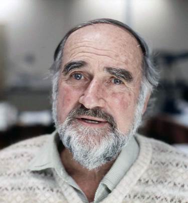
Dave Hocking in August 1987 by Oz Ertok
Dave’s involvement with National Mapping has been documented by himself and others. However, below is listed the varied Dave Hocking specific and related documents with their links.
Copies of Dave’s field and office photographs have been included to further illustrate relevant documents and the links to this material are also given.
Dave took movies whilst in the field and although these films are not available selected stills are included among the photographs.
Papers
Hocking, David Roy (1967), Photogrammetric Planimetric Adjustment, Colloquium on Control for Mapping, University of New South Wales 22-24 May, 1967.
Hocking, David Roy (1985), Star Tracking for Mapping - An Account of Astrofix Surveys by the Division of National Mapping During 1948-52, Proceedings 27th Australian Survey Congress, Alice Springs, Paper 3, pp.13-26. (Additional photos may be found towards the end of this website version of Dave’s paper. These Astro surveys made the newspapers of the time :
http://trove.nla.gov.au/ndp/del/article/49990150?searchTerm=Dave
http://trove.nla.gov.au/ndp/del/article/35776165?searchTerm=Dave )
Hocking, David Roy (1987), Mapping Data and the National Mapping Programme, The Globe, No.28, pp.31-37.
Hocking, David Roy (1998), NATMAP Early Days, Map Compilation from Aerial Photographs 1948–1970s, The Globe, No.47, pp.16-33.
Dave’s photographs (from camera and movie) appear in the webwite version of :
Ford, Reginald Arthur (1979),The Division of National Mapping’s part in the Geodetic Survey of Australia, The Australian Surveyor, Vol.29, No.6, pp.375-427; Vol.29, No.7, pp.465-536; Vol.29, No.8, pp.581-638, specifically :
1949 Bass Strait Reconnaissance and Marking
1951 Eyre Peninsula Triangulation
1952-53 Bass Strait Triangulation
and
Gregory Hall (Natmap’s Early Melbourne Home) : http://xnatmap.org/adnm/docs/0inmin/ghall/ghall.htm
Archived documents saved by Dave :
These circa 1950 and 1951 documents describe the procedure adopted in compiling photo mosaics.
A circa 1965 document describing how existing slotted template radial triangulation techniques could be utilized in forthcoming mapping programs.
Natmap News :
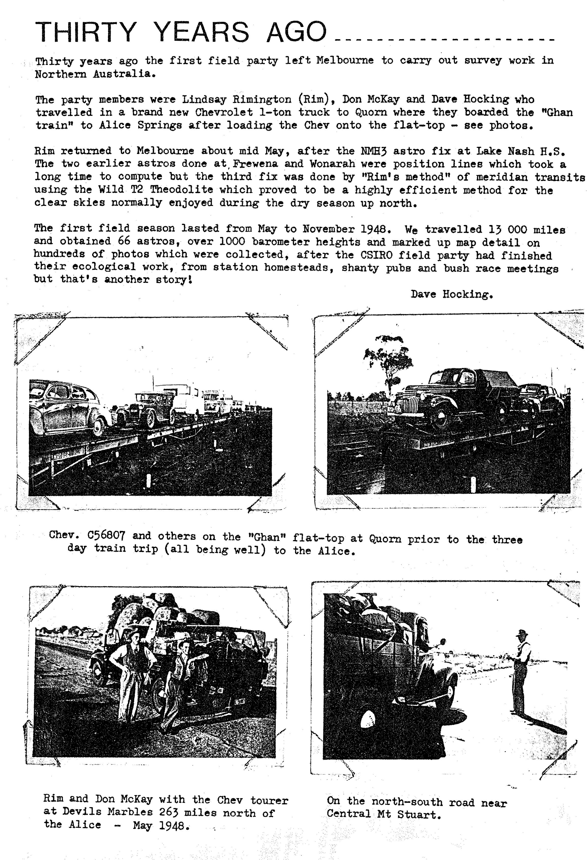
Recollecting his first field trip : Natmap News No.14, April 1978
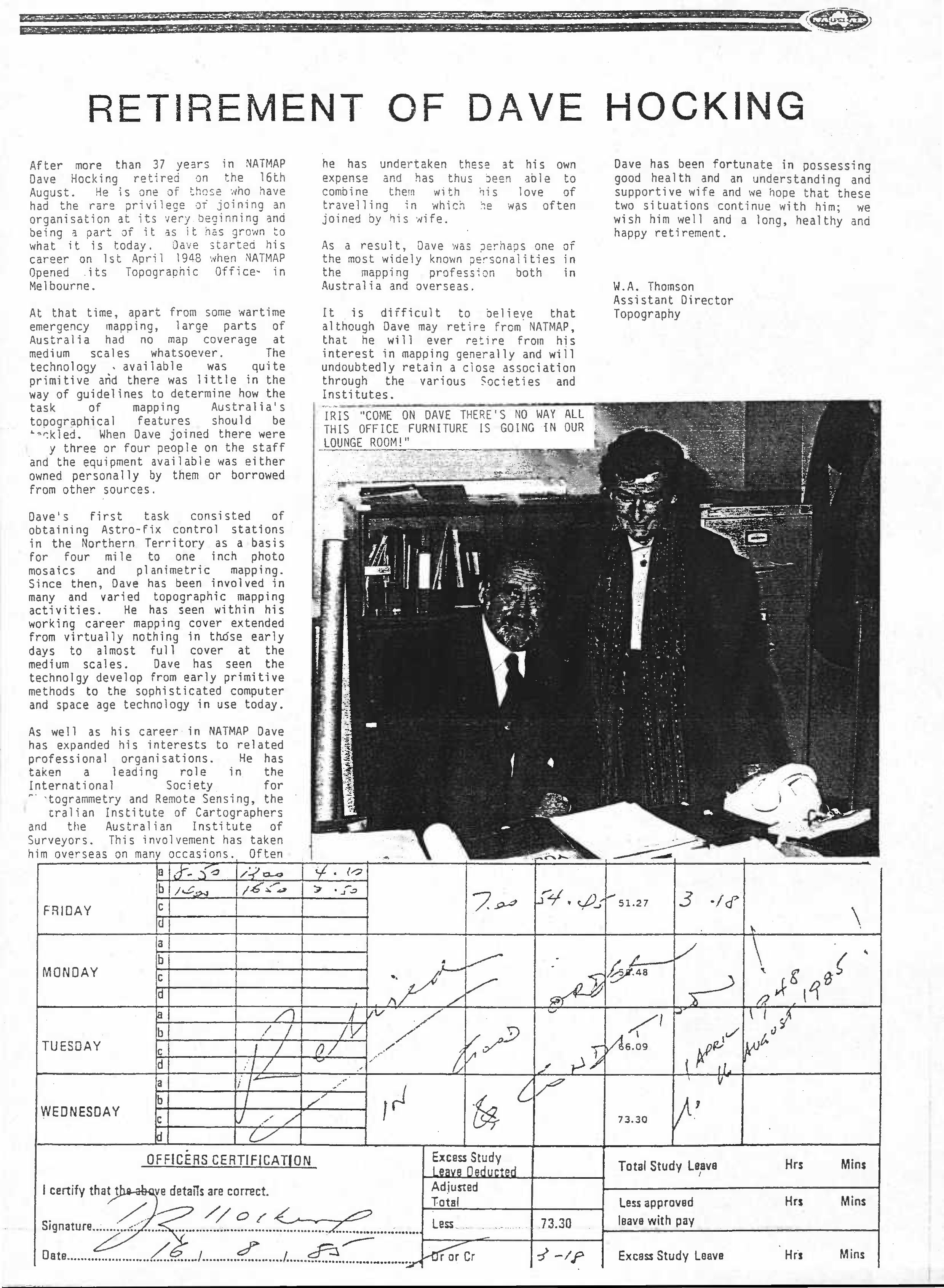
His retirement : Natmap News No.52, August 1985 and frames 6-10 : http://www.xnatmap.org/adnm/photos/retirements/odwalbum/odwalb.htm
Obituary – The Age newspaper of 7 December 2000 :
David Roy (Dave) Hocking Surveyor and Cartographer